ArcGIS Pro Intelligence

ArcGIS Pro Intelligence is a powerful tool designed for intelligence analysts. It enables users to create 2D and 3D maps, link analysis, timelines, and more, to help them make informed decisions in the military, civilian intelligence agencies, law enforcement, and private sector.▼
Course Feature
![]() Cost:
Cost:
Free
![]() Provider:
Provider:
Youtube
![]() Certificate:
Certificate:
Paid Certification
![]() Language:
Language:
English
![]() Start Date:
Start Date:
On-Demand
Course Overview
❗The content presented here is sourced directly from Youtube platform. For comprehensive course details, including enrollment information, simply click on the 'Go to class' link on our website.
Updated in [February 21st, 2023]
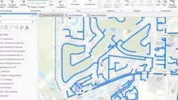
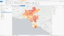
ArcGIS Pro Intelligence is built for the intelligence analyst. Intelligence analysts working in the military, for civilian intelligence agencies, in law enforcement, and in the private sector are using the 2D and 3D maps, link analysis, timelines, imagery exploitation, and graphs to uncover patterns, trends, and relationships to inform decision-making. ArcGIS Pro Intelligence scales to meet your mission whether you need to understand pattern of life, conduct movement analysis, or provide investigative support. ArcGIS Pro Intelligence is interoperable and extensible, supporting your data integration strategy across multiple domains, in connected, disconnected, and air-gapped networks. Follow this playlist for the latest information on ArcGIS Pro Intelligence.
(Please note that we obtained the following content based on information that users may want to know, such as skills, applicable scenarios, future development, etc., combined with AI tools, and have been manually reviewed)
Learners can learn a variety of skills from ArcGIS Pro Intelligence, including:
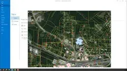
1. Map Creation: Learners can create 2D and 3D maps to visualize data and uncover patterns, trends, and relationships.
2. Link Analysis: Learners can use link analysis to identify connections between entities and uncover hidden relationships.
3. Timelines: Learners can use timelines to track events and activities over time.
4. Imagery Exploitation: Learners can use imagery to identify objects, people, and activities.
5. Graphs: Learners can use graphs to visualize data and uncover relationships between entities.
6. Data Integration: Learners can use ArcGIS Pro Intelligence to integrate data from multiple domains and networks.
Course Provider